


PLAINS TWP WD 05, Luzerne County, Pennsylvania
About
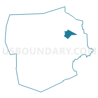
Outline

Summary
| Unique Area Identifier | 660851 |
| Name | PLAINS TWP WD 05 |
| County | Luzerne County |
| State | Pennsylvania |
| Area (square miles) | 8.83 |
| Land Area (square miles) | 8.77 |
| Water Area (square miles) | 0.06 |
| % of Land Area | 99.35 |
| % of Water Area | 0.65 |
| Latitude of the Internal Point | 41.25758050 |
| Longtitude of the Internal Point | -75.80162200 |
Maps


Graphs
Select a template below for downloading or customizing gragh for PLAINS TWP WD 05, Luzerne County, Pennsylvania


Neighbors
Neighoring Voting District (by Name) Neighboring Voting District on the Map
- BEAR CREEK TWP DIST 01, Luzerne County, PA
- JENKINS TWP WD 01, Luzerne County, PA
- LAFLIN Voting District, Luzerne County, PA
- LAUREL RUN Voting District, Luzerne County, PA
- PLAINS TWP WD 04, Luzerne County, PA
- WILKES-BARRE CITY WD 01, Luzerne County, PA
- WILKES-BARRE CITY WD 02, Luzerne County, PA
- WILKES-BARRE TWP WD 02, Luzerne County, PA
- WILKES-BARRE TWP WD 03, Luzerne County, PA
Top 10 Neighboring County Subdivision (by Population) Neighboring County Subdivision on the Map
- Wilkes-Barre city, Luzerne County, PA (41,498)
- Plains township, Luzerne County, PA (9,961)
- Jenkins township, Luzerne County, PA (4,442)
- Wilkes-Barre township, Luzerne County, PA (2,967)
- Bear Creek township, Luzerne County, PA (2,774)
- Laflin borough, Luzerne County, PA (1,487)
- Laurel Run borough, Luzerne County, PA (500)
Top 10 Neighboring Place (by Population) Neighboring Place on the Map
- Wilkes-Barre city, PA (41,498)
- Laflin borough, PA (1,487)
- Hudson CDP, PA (1,443)
- Laurel Run borough, PA (500)
Top 10 Neighboring Unified School District (by Population) Neighboring Unified School District on the Map
Top 10 Neighboring State Legislative District Lower Chamber (by Population) Neighboring State Legislative District Lower Chamber on the Map
- State House District 118, PA (67,168)
- State House District 119, PA (58,443)
- State House District 121, PA (57,813)
Top 10 Neighboring State Legislative District Upper Chamber (by Population) Neighboring State Legislative District Upper Chamber on the Map
Top 10 Neighboring 111th Congressional District (by Population) Neighboring 111th Congressional District on the Map
Top 10 Neighboring Census Tract (by Population) Neighboring Census Tract on the Map
- Census Tract 2119, Luzerne County, PA (6,147)
- Census Tract 2117.01, Luzerne County, PA (5,049)
- Census Tract 2153, Luzerne County, PA (3,966)
- Census Tract 2152, Luzerne County, PA (2,967)
- Census Tract 2016, Luzerne County, PA (2,833)
- Census Tract 2015, Luzerne County, PA (2,315)
- Census Tract 2118, Luzerne County, PA (1,886)
- Census Tract 2117.02, Luzerne County, PA (1,487)